A Geographic Understanding of Uganda
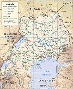
Uganda, a British colony until 1962, is landlocked by its neighbors: Democratic Republic of the Congo, Sudan, Kenya, Tanzania, and Rwanda. It harbors many mountains and several lakes, with the one of the Nile River's sources, Lake Victoria, residing within its borders. It has a natural border along the west with DRC and Rwanda, which is composed of the Virunga (Mufumbiro) Mountains, the Ruwenzori Range, and the Western Rift Valley.
Its location on the equator makes for fairly consistent weather, although the north sees more dry seasons versus the south's wet. This combination across the nation make it ideal for agricultural success with a primary crop being coffee (g48).
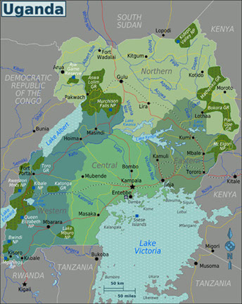
Central Uganda
Eastern Uganda
Northern Uganda
Western Uganda
Regions
Uganda is broken into four main regions: Central, Northern, Western, and Eastern, which are then divided into 111 districts. The naming of each district is based off of the main commercial and administrative town, or "Chief Town" in each. The state is ethnically and linguistically diverse due to its rich history that extends well before its British Colonial rule. Due to this diversity though, it can be difficult to govern, especially with a high percentage of its population living in the mostly rural nation.
The diversity within the nation results in political unrest, but this cultural richness is also what makes Uganda the "Pearl of Africa," along with its biodiversity. Lake Victory holds particular appeal with it being Africa's largest lake and the world's largest tropical lake. It also has numerous islands throughout it and acts as a division between Kenya and Tanzania, Uganda's ocean-facing neighbors. Keeping positive relations with these nations helps to lessen the burden of being landlocked (g46).