| Click images for more maps |
 |
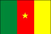
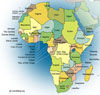
Political map of Cameroon showing towns, cities, territories, boundaries and some surrounding countries. Many of the cultural challenges faced in Cameroon deal with the many ethnic and religious groups that live there. The Doualas are the most educated people and constitute the elite along the coastal region. Cameroon is divided along the Bantu line. Identifying all 200 of the country's ethnic groups is nearly impossible. The capital Yaounde is the more urban area of the country that differs greatly from the culture in rural regions. Until 1972 when Cameroon ecame a unitary state the country was divided because of colonial territories. British Cameroon falls in the souther region of the country and French Cameroon made up for most of the country (80%) 1 |
|